Decision support spatial suitability map for Seaweed Farming in India
CMFRI Repository
View Archive Info| Field | Value | |
| Relation |
http://eprints.cmfri.org.in/15429/
DOI:10.13140/RG.2.2.29031.78240 |
|
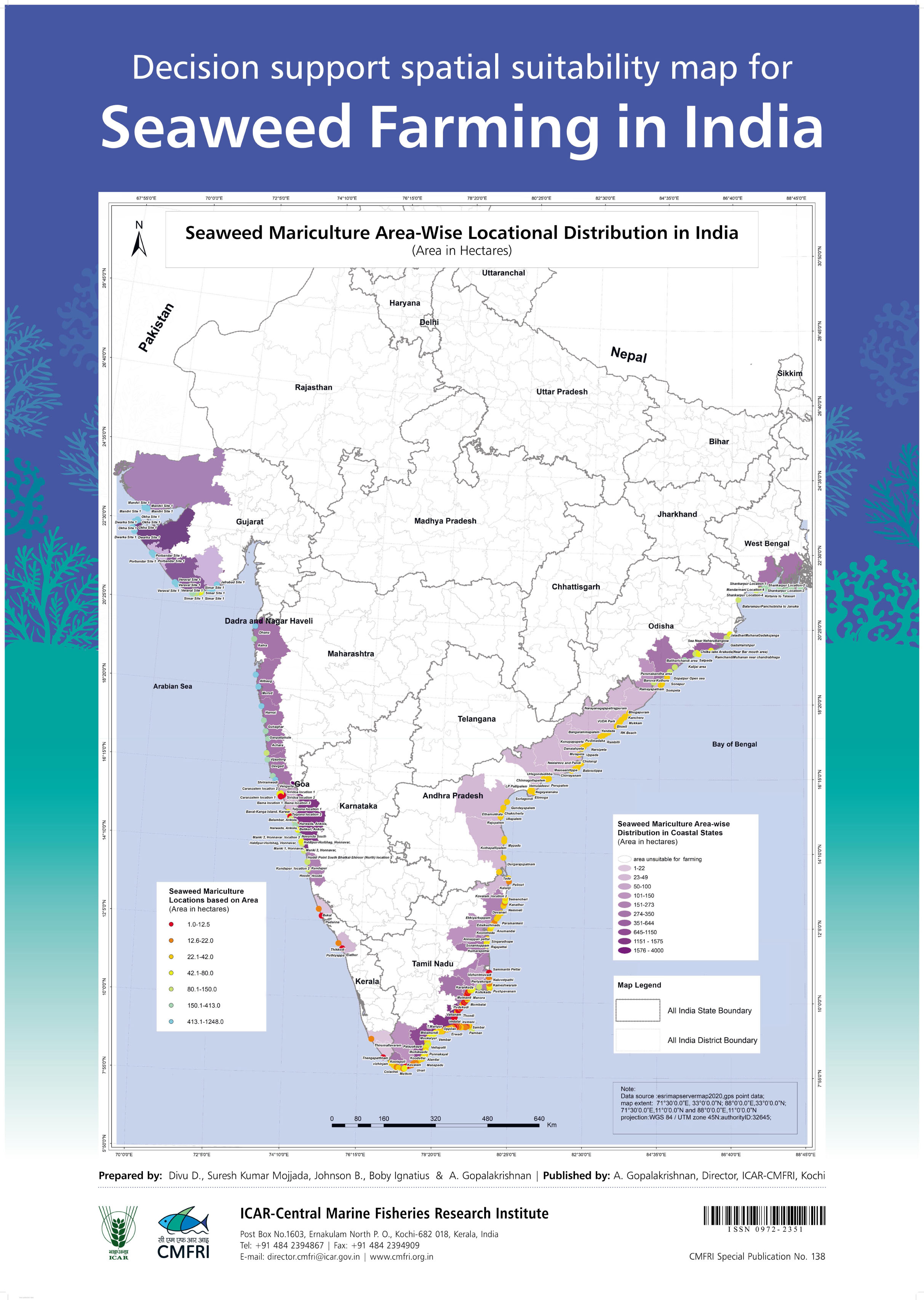
| Title |
Decision support spatial suitability map for Seaweed Farming in India |
|
| Creator |
Divu, D
Mojjada, Suresh Kumar Johnson, B Ignatius, Boby Gopalakrishnan, A |
|
| Subject |
Seaweed
CMFRI Special Publications |
|
| Description |
Decision support spatial suitability map for Seaweed Farming in India. Seaweed Mariculture Area-Wise Locational Distribution in India. |
|
| Publisher |
ICAR-Central Marine Fisheries Research Institute
|
|
| Date |
2021
|
|
| Type |
Article
PeerReviewed |
|
| Format |
image
|
|
| Language |
en
|
|
| Identifier |
http://eprints.cmfri.org.in/15429/1/CMFRI%20Special%20Publication%20No%20138_Decision%20support%20spatial%20suitability%20map%20for%20seaweed%20farming%20in%20India.jpg
Divu, D and Mojjada, Suresh Kumar and Johnson, B and Ignatius, Boby and Gopalakrishnan, A (2021) Decision support spatial suitability map for Seaweed Farming in India. CMFRI Special Publication (138). |
|